Friday, November 18, 2016
Wednesday, December 3, 2014
Nova Scotia weather links
Here I am just going to list and update the most useful links I can find for Nova Scotia weather. I'll update as I find additional links. If anyone reads this and has some good links please share :).
https://weather.gc.ca/city/pages/ns-40_metric_e.html
Plots of observations:
https://weather.gc.ca/analysis/index_e.html
http://weather.unisys.com/surface/sfc_ecan.gif
Some basics:
Worth remembering 0 Celsius = 32 Fahrenheit for those used to C looking at F plots.
Key sites:
Current surface analyses:
Radar:
Current radar:
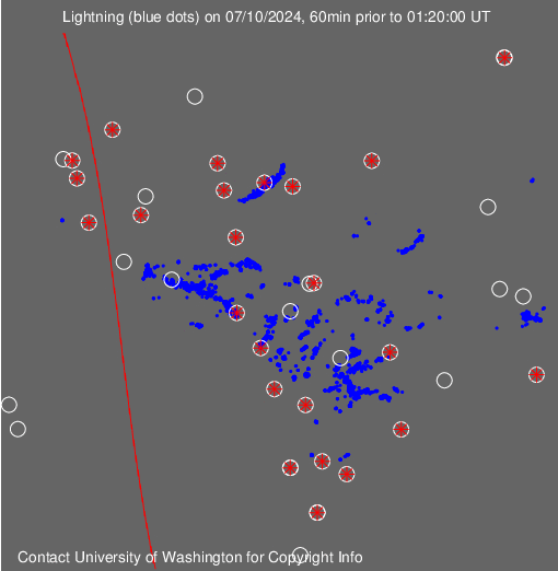
Lightning
Model forecasts:
NCEP GFS and other models:
RAP, NAM, and GFS from rap weather:
Snowfall forecast:
Written forecasts/discussions:
Halifax (Shearwater) I guess this is the best for Halifax since it is by the coast, unlike the airport.
Surface observations:
Current conditions in Halifax Shearwater:https://weather.gc.ca/city/pages/ns-40_metric_e.html
Plots of observations:
https://weather.gc.ca/analysis/index_e.html
http://weather.unisys.com/surface/sfc_ecan.gif
Satellite
http://weather.gc.ca/satellite/index_e.html#goes_east
MODIS polar orbiter detailed visible images, 2 times a day:
MODIS polar orbiter detailed visible images, 2 times a day:
Forums
Accuweather has a Canadian forum.
Tuesday, December 2, 2014
Snow on Thursday morning in Halifax?
Thursday 4 Dec update: The post below (written on Tuesday 2 Dec) shows how wrong I was and how right the Environment Canada forecast was. No snow at all fell on Thu morning and it was fairly sunny. I will need to refine my forecasting skills a lot.
----------------------------------------------------Tuesday post below---------------------------------------------
Currently a low pressure is forecast to develop over east Canada over the next couple of days. My question is over the forecast. Environment Canada says for Thurday's weather that it will be "Sunny". The GFS suggests precipitation and the 540 and 528 thickness lines will spread across Nova Scotia brisk WSW flow by 500 am on Thu (shown on image below). To my eyes this suggests a fairly decent fall of snow but I have only looked at the GFS model. Perhaps environment Canada just keeps it simple a few days out as it may know how tricky the forecast is in the this area of the globe. We shall see. The precipitation does clear but not until Thu afternoon in this model.

Sunday, November 9, 2014
The Grand (Melbourne) Triangle bike route
On 9 November 2014 Alex, Pili, and I cycled the Grand Melbourne Triangle Route (that is at least the name that I am giving it). The route forms a 118 km triangle through the eastern and southeastern suburbs. I have done this once before and really enjoyed it. The vast majority of the route is on off road bike paths, some are unpaved but none are difficult and all are suited for any kind of bike. It took us about 9 hours, that includes two ~20 minute breaks for lunch and a snack. We left at 8:15 am and got back around 5:00 pm.


A Google maps link for more detail on the route is here.
Route Description
Our starting point was 101 Manningham St and this point (A) marked the first vertex of the triangle. First the route joins the Capital City Trail heading east around the north of the centre of Melbourne. After passing under Heidelberg Road bridge and climbing the short very steep hill, the route turns right to cross Heidleberg Road Bridge (point B). Either bike through the park bike paths or along the road to reach the beautiful pedestrian bridge that crosses the Yarra River near the Fairfield Park Boathouse. The route now follows the Yarra Trail until the junction where the Yarra Trail crosses the river in Burke Road Billabong Reserve (point C). Instead of crossing the river continue straight, under Burke Road then through a tunnel under the Eastern Freeway to join the Koonung Creek Trail heading east. This trail takes you east and eventually turns into the Mullum Mullum Creek Trail which passes through some great bushland in Yarran Dheran Reserve.
Follow these trails east for 16.5 km until you pass under the complicated highway junction where the second vertex of the triangle is located (point D).
Now the route south begins, follow the Eastlink Trail for 6 km.

When you reach a junction with a dirt walking bike track (point E) it is nice to turn right. This is easy to miss and not a big deal if you do as you can rejoin the route later. The reason for going right here is that there is a nice wooden boardwalk over some swamps as well as some other nice sections.

Bike 5.5 km from point E to point F, along the way the trail becomes the Dandenong Creek Trail at some point (Point F marks a junction that you can reach in case you missed the junction at point E and continued down the Eastlink Trail and turned right along the Blind Creek trail). From point F the route follows the Dandenong Creek Trail for some 31 km until you reach the sea at Carrum Port at point H. Along the way is Jells Park, a great place to stop for lunch. Look out for the bridge crossing in Dandenong Park at point G, it is not clearly signposted that you have to cross it.

The final section before reaching the coast is along the left bank of the broad Patterson River that Dandenong Creek flows into.

Finally a celebration is in order as you reach the sea at Carrum and enjoy the expanse of blue and beaches spreading out in both directions.

This is the 3rd vertex, now begins the long trek along the coast back to the 1st vertex. You can actually see the tops of the Melbourne skyscrapers from here, gives an indication of the distance you have to travel to get back home.

Unfortunately you have to follow an on road bike lane along Statton St for 7.5 km to reach Mordialloc after which things improve. Bike along bike paths or along Beach Road until the reliable and consistent bike path begins at point I. Now amble up the coast on the fantastic Bay Trail.When you reach a junction with a dirt walking bike track (point E) it is nice to turn right. This is easy to miss and not a big deal if you do as you can rejoin the route later. The reason for going right here is that there is a nice wooden boardwalk over some swamps as well as some other nice sections.
Bike 5.5 km from point E to point F, along the way the trail becomes the Dandenong Creek Trail at some point (Point F marks a junction that you can reach in case you missed the junction at point E and continued down the Eastlink Trail and turned right along the Blind Creek trail). From point F the route follows the Dandenong Creek Trail for some 31 km until you reach the sea at Carrum Port at point H. Along the way is Jells Park, a great place to stop for lunch. Look out for the bridge crossing in Dandenong Park at point G, it is not clearly signposted that you have to cross it.
The final section before reaching the coast is along the left bank of the broad Patterson River that Dandenong Creek flows into.
Finally a celebration is in order as you reach the sea at Carrum and enjoy the expanse of blue and beaches spreading out in both directions.
This is the 3rd vertex, now begins the long trek along the coast back to the 1st vertex. You can actually see the tops of the Melbourne skyscrapers from here, gives an indication of the distance you have to travel to get back home.
The trail continues non-stop for 20.5 km until finally you reach the Spirit of Tasmania terminal at point J. From here follow the bike path northeastward towards the city, join the Capital City Trail again and head through Docklands and then north to return to the starting point A. Enjoy a cool beer and take a nap.
Friday, November 7, 2014
East Gippsland cycle tour
This was a great week adventure with a rail trail to begin with followed by an adventurous route along the coast that ended in Bemm River. Touring inland through Cabbage Creek then into the mountains on some testing dirt tracks into the Snowy Mountain wilderness before returning to Orbost. A blog of the various sections will follow and a map of the route is linked below:
Or below is a link, may allow you to view satellite, road map etc. Just click the map on the left and it will link to the route on MapMyRide.
Or below is a link, may allow you to view satellite, road map etc. Just click the map on the left and it will link to the route on MapMyRide.
The Grand (Melbourne) Triangle bike route
The Grand Triangle
The map linked below is of a cycling route that forms a giant triangle through the eastern and southeastern Melbourne suburbs. Pili, Alex and I will attempt this 118 km route on Sunday hopefully. I did it a while back and enjoyed the variety of the route as well as the fact that most of it is through parkland and on bike paths. Hopefully the link below will work:
View Larger Map
Monday, February 18, 2013
Monday 18 February 2013 Victoria fires
Fires across Victoria today. Plume visible across east Melbourne from Donnybrook fire. Working on a time lapse of view from the Bureau.

I sent the link to The Age and they put the video in their story on the fires:
Subscribe to:
Posts (Atom)